Stoke Gabriel is a village in South Devon on the east bank of the River Dart.
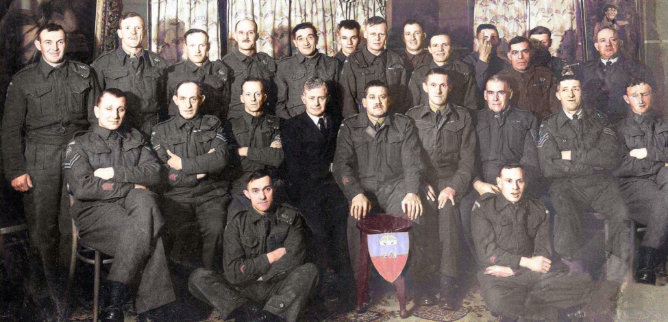
| Name | Occupation | Posted from | Until |
|---|---|---|---|
| Sergeant Alfred John King | Transport driver |
26 Sep 1940 | 03 Dec 1944 |
| Corporal Alfred James Collings | Horseman |
23 Sep 1941 | 03 Dec 1944 |
| Private Reginald Victor Baker | Sand barge worker |
28 Sep 1941 | 03 Dec 1944 |
| Private Francis Leslie Chubb | Farm carter and horseman |
23 Sep 1941 | 03 Dec 1944 |
| Private Frederick John Hodge | Timber worker |
23 Sep 1941 | 03 Dec 1944 |
| Private Charles Kiff | Gardener |
28 Feb 1943 | 03 Dec 1944 |
| Private Edwin Prince Potham | Farm worker |
28 Sep 1941 | 03 Dec 1944 |
| Private Alfred Charles Tucker | Farmer and carpenter |
23 Sep 1941 | 12 Mar 1943 |
| Private Charles Neville Watson | Hotel manager |
25 Oct 1941 | 10 Oct 1942 |
The Operational Base is on PRIVATE LAND and was accessed by kind permission of the estate manager.
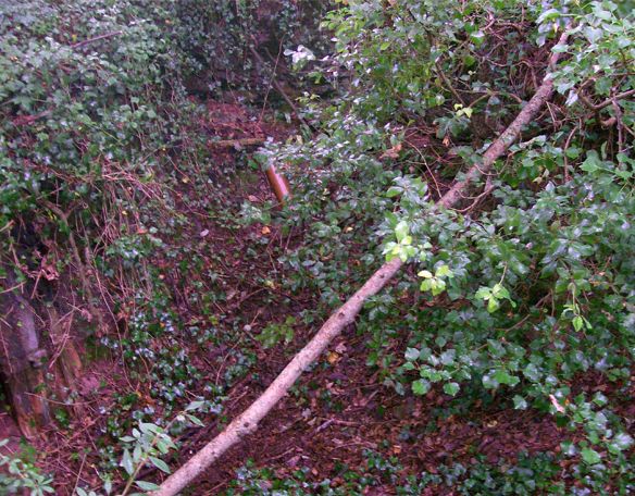
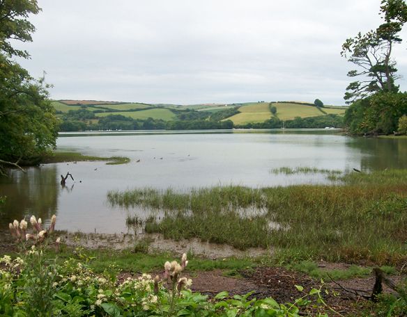
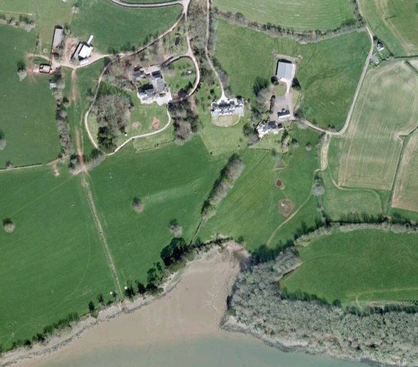
The OB is on the edge of East Wood, below Sandridge Barton on the east bank of the River Dart, downriver from Stoke Gabriel village.
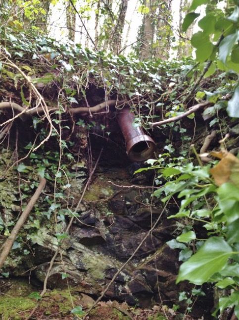
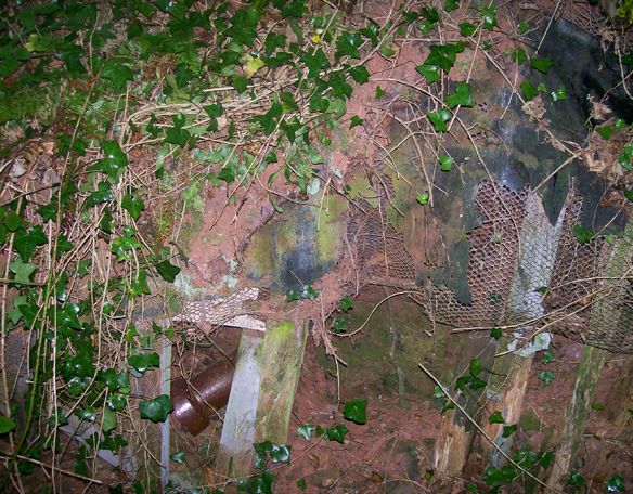
It appears that some attempt has been made, post war, to dismantle the Operational Base though it may have collapsed naturally with the progression of time. Far too many ventilation pipes are intact and in situ for it to have been blown up and the depression in the ground is far too evident for it to have been filled in.
Though overgrown with Ivy and decades of mulch from the trees, a clear outline of the Operational Base can be mapped out, at least 10 feet down into the bedrock. A lack of in-fill behind the remaining wall structure seems to indicate that the original pit was quarried or at least finished by hand to exactly the correct size and design.
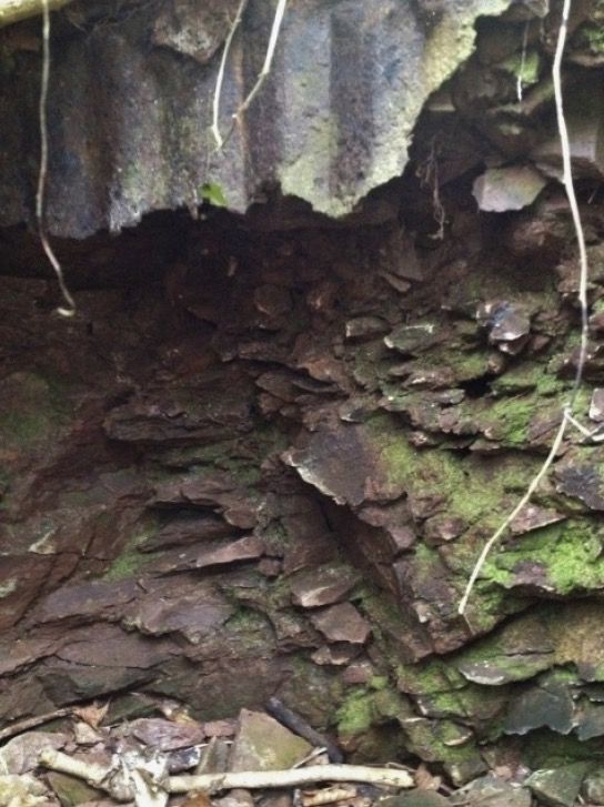
The distinct layers of construction can be seen in the far end wall of the main chamber and this seems to suggest the base was maybe built by the Patrol and may have been altered or added to when construction and materials became more standardised.
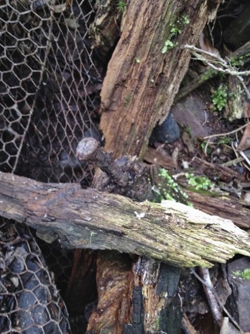
A framework made of 4 inch by 4 inch timber was constructed around the sides of the quarried out area. This was then clad with 4 inch by 1 inch timber to create a wooden hut structure. This was then internally lagged with chicken wire and then roofing felt or possibly damp proof course, though no joins can be seen. The more standard construction material of the corrugated iron Nissen was then placed inside. No evidence remains of any concrete blocks being used.
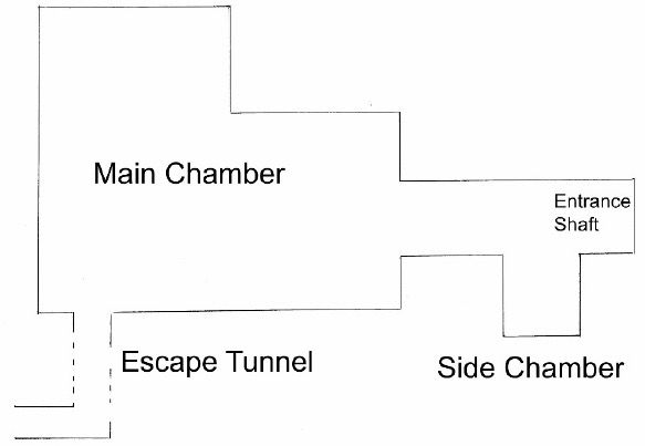
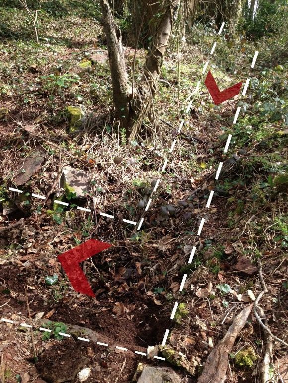
The OB remains show the original structure consisted of a drop down shaft, lined with corrugated iron, leading to a small entrance chamber which had an approximate 4 foot by 3 foot alcove off to the left as seen in the picture which is looking down into the side alcove. After this the main chamber of the OB opens out to an area of around 17 foot by 15 foot with (looking from the entrance shaft) a larger alcove to the right with various ventilation pipes still in situ and the escape tunnel leading off to the left.
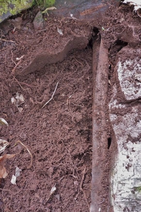
The escape tunnel exits from the main chamber, runs downhill 33 feet and seems to turn a right angle and continue for another 7 feet before terminating near a path and gateway into a field. It appears to have been constructed in a similar way to the main chamber; being 4 feet wide, corrugated iron lines the sides and the presence of 4 inch screws indicates a wooden frame was used for the structure. The length of the tunnel was covered with stones which would have been the spoil from the excavation of the main chamber.
The location of the OB, close to and above the River Dart, would suggest the best location for a observation post would actually be on lower ground, closer to the river edge. The wood continues down the river bank, almost to the waters edge, so they could have good visibility up and down the Dart whilst still well concealed by trees. They may have made use of the boathouse.
During the preparations for D-Day, Allied forces were based in the nearby fields. Many trees, only yards from the OB, have military arborglyphs (graffiti) carved by American personnel.
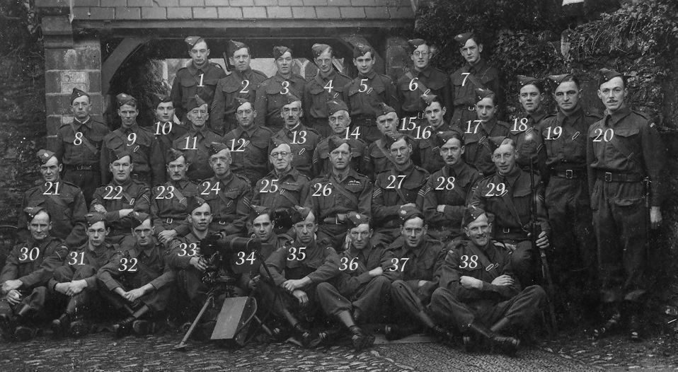
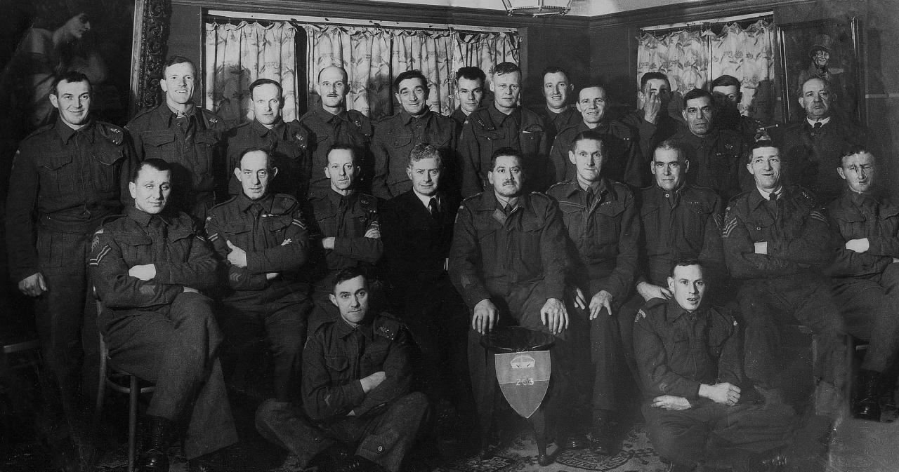
Stoke Gabriel Patrol
As there are few important road or rail links close to Stoke Gabriel it is assumed that the most obvious target would have been traffic on the strategically important River Dart.
It is assumed they were issued with the standard kit, arms and explosives.
Like Philliegh Patrol on the River Fal in Cornwall here is a thought that due to Stoke Gabriel's location next to the extremely strategically important River Dart they may have been issued with Limpet Mines.
Just downstream from the OB was another wartime clandestine operation. The 15th Motor Gunboat Flotilla of the Royal Navy used to lie midstream in the River Dart alongside an old paddle steamer, 'Westward-Ho!'
This flotilla carried out clandestine operations from the River Dart to Northern Brittany from 1942 to 1944. Working closely with the French Resistance, it landed or brought back many British and Allied agents supporting intelligence and escape networks and SOE (Special Operations Executive).
In 1941 the Nazis produced a folder containing maps and booklets that were intended to be used as military intelligence documents for invasion.
In preparing for the invasion a vast amount of information, including maps and photographs, was assembled by the German military which resulted in the production of a series of military/geographical assessments, showing what might be found by those arriving.
There are two pictures of the River Dart, one an aerial view with the caption of 'a harbour of refuge' and the one above taken from the east bank looking up towards Stoke Gabriel.
George Collings recalls; "My uncle Jim Collings was an Auxillier as was my godfather Charlie Kiff. For the last two years in Stoke my father Frank (a Lieutenant in the Home Guard until he was called up in late 1942) was gardener at Waddeton Court and we lived in the cottage opposite the Court front gates. Charlie lived in Sandridge Park Coach House and the back windows overlooked the Operational Base. A friend's mother was cook at Sandridge Park and we knew the OB was in East Wood but always searched higher up where there are low mounds. There was plenty of WW2 explosive debris for schoolboys to amuse themselves with though".
TNA ref WO199/3391
Hancock data held at B.R.A
Charlie Bircham, George Collings, Bob Scadding, Sylvia nee Tucker, Martyn Allen
1939 Register
The Secret War from the River Dart by Lloyd Boyt