When looking at an Operational Base, a plan can helpful to understand what can be seen in specific photos. It is often difficult to understand a structure from a single image or series of images. But a plan, or series of plans, can only show two dimensions at once.
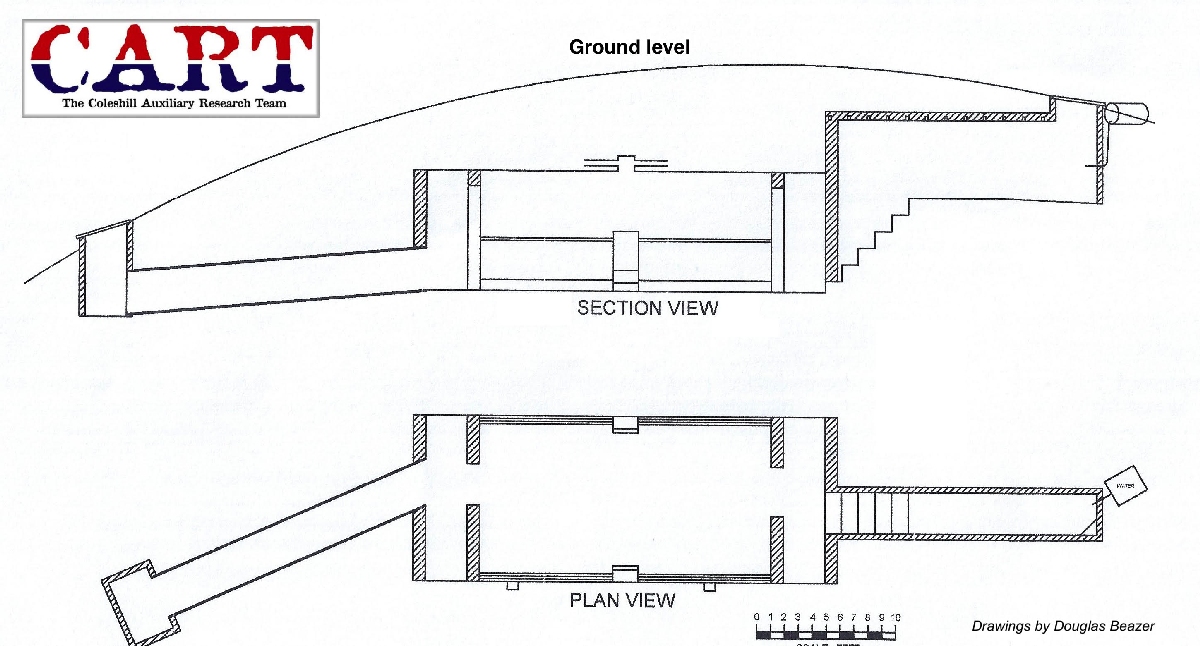
The simplest way to address this is with a sketch, that adds the third dimension. Our Admiralty 4 (Prior Park) Patrol report contains an example of this. The sketch makes clearer how an underground structure is arranged, when that cannot be easily seen from the images alone.
Software has made it possible to build virtual 3D models from measurements of an Operational Base. Once the realm of specialists, there are now entry level software options to build a virtual 3D model and colour it to create an accurate reconstruction of an OB that may be collapsed or overgrown. An example of this can be seen with these images of a very overgrown OB at Portesham in Dorset, with a simple 3D model showing much more clearly than any of the image the layout of the operational base.
We have been fortunate enough to have a professional showing us how it should be done. Matt Brazier kindly produced a couple of models of Operational Bases for CART and has animated these into a walk through which further improves the understanding of design. We have seen his model of the Salisbury Instation already. He produced another of Operational Base of the Drellingore Patrol. The OB in this instance was collapsed, though the shaft and escape tunnel remain intact. The reconstruction video allowed the original structure to be visualised as it would have been. There is always a risk of introducing interpretation into a model and making assumptions. The initial model of the Binnegar OB seen in the report, assumed the shaft was a rectangle shape. However, once excavated it became clear it was narrower at one end than the other, as can be seen in the images. Experience has shown that you can't take too many measurements and it is is also worth planning a follow up visit to repeat the measurements that were overlooked the first time!
More recently archaeological recording has advanced to incorporate 3D scanning technology. Issues of missed measurements are overcome as the laser scanner takes thousands of measurements to create a point map. This plots each measurement in three dimensions to create a virtual model of the structure. This model can be rendered with either illustrations or photographs mapped onto the images. Recently, AOC Archaeology were contracted by Forestry and Land Scotland to record an Operational Base that came to light during felling works. This was an OB in a relatively good state of preservation, belonging to the Beattock Patrol in the Scottish Borders and ideal for this technique. Of particular interest was the linking of scans above and below ground to generate an illustration of the location of the structure in the landscape. As these structures are vulnerable to rust and other natural damage over time, this has to be the modality of choice to record these structures where possible. We are grateful to AOC for sharing the final report and the images. These images are very effective and certainly captured the imagination of the press, resulting in numerous articles including one in French!